Thursday, July 14, 2016

“Why on Earth would you speed hike?”

The author and Anish crossing paths on the AT.
Anish is smiling, I am grimacing in pain.
Honestly, I wouldn't.

But every year, someone announces their intention to attempt a speed record on a long distance trail.  And as inevitable as that is, so too is the chorus of people who feel the need to tell everyone that they can't possibly figure out why anyone would want to do such a thing.

The chorus also seems to have definite ideas of how people who attempt speed records could better spend their time, in much the same way that people who don’t hike trails at all often think that long distance hikers would be much happier if they, say, bought a house, or drove a vehicle that wasn’t 22-years old, or, at the very least, showered more than once every 5 or 6 days.

So it goes without saying that none of us really understands what makes other people happy or why.  Or at least it went without saying right up until just a sentence ago, when I went ahead and said it anyway.

But the Night Hiking To Mars blog is nothing if not informative, and so we present to you the results of a survey we’re pretending to have done, in which we asked “speed hikers” what benefits they derive from hiking an entire trail in the time it takes me to eat a half gallon of ice cream at Pine Grove Furnace State Park.

The Top Ten Benefits Of Speed Hiking

#10: Getting to smell the roses at 4am, when their odor is less likely to be overpowered by hiker funk.

#9: Dramatic reduction in the number of times you’ll hear Wagon Wheel.

#8: On trail at both dusk AND dawn, thus increasing the number of Bigfoot encounters.

#7: Pink Blazers give up after half a day.

#6: Getting to hear the part where people say “Hike Your Own Hike, but . . .” and being out of earshot by the time they’re telling you what you’re doing wrong.

#5: Fewer hotel stays means more money to spend on whiskey and Honey Buns.

#4: Acquiring the knowledge of what it feels like to elevate your chafe game from a minor annoyance to a full blown medical condition that requires skin grafts and rehab.

#3: Quickly outpacing people who want to tell you all of the advantages of hammocking.

#2: Ability to annoy internet “hikers” without having to suffer the indignity of starting a gofundme campaign.

And finally:

#1: By the time the giardia symptoms appear, you’re already sitting on your toilet at home.


Dedicated with love to my very fast friends, some record setters and others just plain speedy, whom I support without understanding you at all -- Anish, Tatu Jo, Snorkel, Trauma, Swami, Lint, and any other lunatics whom I'm forgetting.


Sunday, March 6, 2016

Guidebooks For Trail Widths: A Review

If I'm delusional, why does this tee exist?
As many of you know, late in 2015 I set the Fastest Known Time for hiking the Twiple Crown, hiking the Widths of the PCT, CDT, and AT in a record 3 days, 6 hours, and 35 minutes.  It was a pretty awesome accomplishment.

Ever since setting the record, I have been bombarded with emails from hikers asking for all sorts of information and advice concerning hiking the Widths of the Trails, also known as Side To Side Hikes (or S2S).  And while that previous sentence is absolutely untrue, I think we have to ask ourselves if it’s an outright intentional lie, or if I’m living in some weird fantasy world where hikers not only want to hike Trail Widths, but also one in which people actually read this blog.

Hard to say.  But either way, I’ve decided to offer help via a review of the guidebooks that may or may not be available for hiking the Trail Widths, because frankly I am far too busy customizing my Hiking Eating Helmet to keep answering all of these emails that may or may not be coming in.  So let’s start with the PCT.

Pacific Crest Trail
There’s really only one choice here.  Yogi’s Pacific Crest Trail Width Handbook has all of the information you need to successfully hike the Width of the PCT.  The first part of the book has advice from a number of previous Width Hikers, which is incredibly helpful when in the planning stages of your hike.  The second part is an on-trail guide with all sorts of useful information, including trailhead locations, good places to nap, water sources close to roads, hotels to stay in before your hike and bars to celebrate in afterwards.  Highly recommended!


Continental Divide Trail
As with the PCT, the recommended guide book is put out by Yogi.  Her Continental Divide Trail Handbook Width Edition has the same basic format as the PCT book, so if you’ve used that it will seem familiar.  Admittedly, you can probably get by without a guide book for the PCT Width, but a guide for the CDT Width is a must.  Sometimes there’s no footbed for the Width, sometimes you can be on it and not realize it, and sometimes you think you’re walking the Width of the CDT and you’re really on a game trail.  It also includes such vital information as the best place to buy a velvet John Wayne painting while on trail, where you can ride an enormous stuffed Jackalope, and which restaurants have burgers so large that in order to eat them you have to unhinge your jaw like a snake.


I haven’t used them, but I’ve heard from other Width hikers that the recently completed Jerry Brown Width Map Books are excellent.  Nobody thinks they’re going to get lost while hiking 2-4 feet of trail, but it happens all the time.  Particularly if, like me, you’re easily confused.


Appalachian Trail 
Hiking the Width of the Appalachian Trail is the most popular of the Width hikes out of the three trails, due mainly to its close proximity to large population centers full of lazy people.  Consequently, there are more options.  All of them have their pluses and minuses.


AT Guide

David Miller’s AT Width Guide has information on the distance from one side of the trail to the other for the entire AT, which would seem like overkill if this were an actual book.  It includes the slope of the width as well, integrated into each page using an overlaid slope map.  The nice thing about this guide is that it is available in both Eastbound and Westbound versions.  It also comes inside a heavy duty zip-lock bag, which is perfect for people who live underwater and hikers in the Smokies in April (which is pretty much the same thing).


ASDHA Width-Hikers Companion

The Width-Hikers Companion is compiled every year by Appalachian Short Distance Hikers Association volunteer field editors and is available from that organization as well as the ATC.  It has excellent information on trailhead locations, which is ideal for driving to the trail and walking three feet.  There is a pdf version available as well as a companion phone app, but the 288-page book is the recommended version for starting fires and swatting at mosquitoes.


Width Data Book
All of the information in the ATC-published Data Book is available in both the AT Guide and the Companion, but it is the smallest, lightest option and is recommended for UL Width Hikers which, honestly, really should be just about everybody.


There are, of course, other options out there, including not bothering with a guidebook at all.  But whether you’re a planner or a winging-it kind of hiker, keep in mind that with Width Hiking, “The Very Short Journey Is The Almost Immediately Reached Destination.”


Note: For reasons that boggle the mind, some people want to hike the lengths of these things instead of the widths.  Not sure what that's all about.  But if you are one of those lunatics, the same guidebooks are available for lengths!

With thanks to Matt Bowler and Bill Garlinghouse for help with terminology!

Sunday, February 21, 2016

Hiking Memes Volume Two

This is the second volume of hiking memes I've put together for your enjoyment, as a tribute to your good taste.  If this were Buzzfeed I'd say that you won't believe #5, and that this post will CHANGE THE WAY YOU THINK ABOUT EVERYTHING!!!

But it probably won't.  You might laugh a bit, though, and that will be good enough.
Feel free to steal 'em and share 'em, if you're into that kind of thing.


Tuesday, February 2, 2016

The Northern Terminus Of The Appalachian Trail: A Modest Proposal

Katahdin, topped with either clouds or an unacceptable
amount of pot smoke, depending on whom you ask.

The Background


  On November 19th, 2014, Jensen Bissell, the Director of Baxter State Park, sent a letter to Ron Tipton and Wendy Janssen.  Ron Tipton is the Executive Director of the ATC and is also a former AT thru-hiker (1978).  Wendy Janssen is the Superintendent of the Appalachian National Scenic Trail and to my surprise is NOT also the female protagonist in Peter Pan.

In the letter, Director Bissell outlines his concerns about the increasing number of thru-hikers that has risen to a shocking and unsustainable 3% of the 63,000+ annual park gate visitors, and notes that ATC’s vision of more people enjoying outdoor recreation runs counter to the Park Authority’s vision of a “fixed capacity” of non-car driving visitors who will enter the park and not act like complete idiots, or at the very least will not share their acts of idiocy on social media.

In addition to concerns about sheer numbers, the letter includes a list of observed bad behavior and neediness by thru-hikers in the park that is “not meant . . . to serve as a litany of complaints,” but manages to serve quite well in that capacity anyway, in the same way that anything said before the phrase “no offense intended” was probably incredibly offensive.

Summing up, the letter calls on ATC and the NPS to come up with a plan to do something about hiker numbers and behavior in a section of the trail that the letter also points out “has no federal designation and is under the control of the Baxter State Park Authority.”  Director Bissell’s letter was of great concern to the AT hiking community, not only because the previous sentence makes no sense, but also because of the not-so-subtle threat that if someone other than BSPA didn’t come up with a solution, THEIR solution might involve “relocating . . . the trail terminus.”


The 2015 Season


Fast forward to July of 2015, when, as a result of his summit shenanigans, record-setter Scott Jurek was cited for drinking alcohol, spilling alcohol, and for having too large a group with him when he did the previously mentioned things with the alcohol.  In a plea deal Jurek pleaded guilty to drinking and was assessed a fine that Penobscot County District Attorney R. Christopher Almy admitted was $300 greater than a public drinking summons would typically carry under state law.  That may seem unfair, but at least he wasn’t cited for speeding.


It was, however, Jurek’s Clif Bar headband that really seemed to bother Director Bissell.  In a Facebook post, Bissell noted that “Scott Jurek’s physical abilities were recognized by corporations engaged in (selling) running and outdoor related products . . . The race vehicle used to support Scott in his run, as well as Scott’s headband, clearly displays these corporate sponsors.”

And as it turns out Baxter does NOT like corporate commercialism, which might come as a bit of a surprise to L.L. Bean, not only because they received four commercial filming permits in Baxter from 2012 to 2013, but also because they sell a line of jackets called “Baxter State Parkas."
Just in case you thought "Baxter
State Parkas" was a joke.
One would think that the simple solution to people breaking the rules in Baxter State Park, regardless of who they are or how they got there, would be for Baxter State Park employees to enforce the rules they are tasked with enforcing.  It turns out that many people stop breaking rules once it becomes clear that there are consequences, which is why, for example, “Mooning The Cog” on Mount Washington isn’t as much of a thing anymore, and why most hikers get Smokies Permits when they hear there’s a Ranger checking for them at Newfound Gap.


But in the past few months there have been a series of meetings involving BSPA, ATC, NPS, MATC, ALDHA, FBSP, and, oh, I don’t know, HYOH, NIMBY, and YMMV, and “enforce the Park rules for everyone” doesn’t seem to have been an option anyone is particularly interested in attempting.


The Proposal


My initial thought was that the solution lay in getting Clif Bar to sponsor every thru-hiker, since it seems that Baxter is only interested in citing high profile, sponsored hikers for the sake of making a point.  This, however, seems like an unlikely solution.  Clif Bar couldn’t possibly be interested in sponsoring hundreds of willfully homeless dirtbags with entitlement issues and delusions of grandeur.  And from the other direction, thru-hikers wouldn’t be interested in Clif Bar sponsorships because after two months of eating them Clif Bars taste like cardboard and despair.

And even if that plan was possible, it wouldn’t account for Baxter’s concerns about the sheer numbers of hikers, because, as previously mentioned, Baxter has a “fixed capacity model” in place.

Unless maybe you’re a visitor who isn’t on the AT.
In 2014 Baxter State Park had 63,049 folks come in through their gates.  Back in 2002 the number was 8,605 people higher (71,654!), or more than four times the number who came into (or out of) the park via the Appalachian Trail in 2014.  I suppose that if you can fit inside a vehicle you can also fit into Governor Percival Baxter’s vision.   

In any case, Baxter apparently can’t handle more AT hikers.  We’ll just have to take their word for it.

So the only rational option left is to bypass Baxter State Park entirely and move the Northern Terminus of the Appalachian Trail to the A.T. Cafe in Millinocket.


The new proposed route for the AT

After crossing Abol Bridge, with its magnificent views of Katahdin, Northbounders would continue along the Golden Road for an additional 19.4 miles and finish their hikes at a terminus sign on the sidewalk in front of the Cafe on Penobscot Avenue.  Along the way they’ll walk along the confusingly named River Pond, enjoy striking views of Millinocket Lake, and try desperately to see and breathe as loggers and hunters throw up clouds of dust at high speeds.  As an added bonus, siting the A.T. on a road means that “thru-hikers” who have been yellow blazing up the trail can get in one last celebratory hitch before heading home and submitting to the ATC for their 2000-Miler certificates and patches.


A triumphant end to a thru-hike!
Moving a terminus may seem extreme, but the A.T. has a history of doing so.  In 1958, the southern terminus of the Appalachian Trail was moved from Mount Oglethorpe (arguably a more dramatic mountain than Springer) after hikers complained about being covered in a thick layer of chicken poop.  Today, southbounders claim that finishing their hikes on Springer is not at all depressing or anti-climactic.

And although they are absolutely lying about that, for the purposes of this editorial we’ll pretend to believe them.

And so it will be with the relatively chicken-poop-free A.T. Cafe.  Northbound hikers will finish their hikes and be able to celebrate by doing things that would be objectionable in the Park -- they can have a beer AND a milkshake without worrying about spilling either on the ground.  They can write their name on things (in this case, ceiling tiles).

Tagging in the AT Cafe.
They can get a place to sleep in town without “strain[ing] the current system beyond its capacity.”  Southbound hikers can start their trip with a cheeseburger AND not have to deal with the logistics of getting to Baxter.  And should a hiker do anything in the A.T. Cafe that the staff finds objectionable, I am confident they will kick the offender out on their ass without feeling the need to enlist the aid of the ATC or complain to the Portland Press Herald.

Bonus: Summit Sundae NOT available on summit of Katahdin.
 As you can imagine, though, I would highly recommend getting a shuttle into Baxter State Park to walk up Katahdin once a thru-hiker’s trip on the A.T. is completed (or before it begins, for southbounders).  It would be a shame to be so close to such a magnificent mountain and not climb it, and who knows when they’d be that close again? 

Of course, at that point Baxter’s distinction between “AT Hikers” (“a user group not defined in [their] trust mission”) and “members of the public” (a group that apparently is part of the trust mission but doesn’t include thru-hikers) disappears.
They’ll just be visitors in the park, no different than any other hiker on the mountain, and their behavior won’t be the responsibility of (or reflect poorly on) anyone but themselves.

The Beginning Of A New Ending?


Photo Credit: Katahdin Photo by Michael Muzzillo


Wednesday, January 13, 2016

"Wild" Debates On The PCT (Part 3): Sharing The Trail

The Pacific Crest Trail is a National Scenic Trail that stretches approximately 2,650 miles from Mexico to Canada through California, the State of Jefferson, Oregon, and Washington.  Previous entries in this series have focused on overcrowding issues related only to hikers; Part One of this series focused on hikers carrying large pieces of furniture on the PCT, and in Part Two we looked at the contoversy surrounding caches of office supplies.


But as the 2016 hiking season approaches, a vocal group of “Share The Trail” advocates is once again pushing for access to the Pacific Crest Trail, hoping to open the trail to uses beyond hiking and horse-packing.  Which brings us to the subject of part three of this series: sharing the trail with NASCAR drivers.

Proponents of the status quo believe that In order to continue to protect the trail as a resource and to provide a safe and unique recreation experience for the primary users – hikers and equestrians -- other forms of outdoor activities must be banned.

But if NASCAR enthusiasts have their way, that will soon change.  “Our mission is simple,” says Kyle Busch fan Kevin Gallagher, “we hope to join the PCT community . . . as with other dedicated members of the PCT community, our primary goal is to protect, preserve and promote the PCT in homage to its world-class significance, for the enjoyment, education and adventure of hikers, equestrians and stockcar racers alike.”*

People who drive stockcars and their fans feel that they have been unjustifiably excluded not just from the trail, but also from the process of deciding who gets to use it, and have expressed their frustration via social media: 

"The damage to the ground is done by the trail builders . . . everything after that is negligible."* -- Wendi Merritt


The NASCAR Perspective

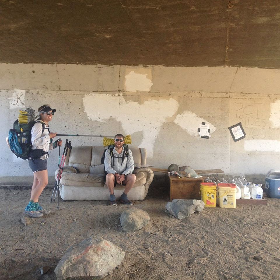
A number of arguments have been put forth by racing fans to justify a change in the rules.  Some claim that historically, NASCAR was a part of the trail.  “Prior to 1988, there were stockcars all over the place legally, and there was never a problem,” says Denny Hamlin fan David Vitti.  “Admittedly, there’s no real evidence to back up those claims, but I do have a nice black and white photo of a group of NASCAR enthusiasts on the PCT in Oregon, so there’s that.”

A nice black and white photo of a group of NASCAR enthusiasts
on the PCT in Oregon

Others point out that stockcars create less impact than backpackers or equestrians.
As Kevin Harvick fan Steve Cain points out, “regarding impacts, a NASCAR driver passing through on an all-day type of drive isn't usually setting up camp, collecting wood for a campfire, rinsing off in a stream or lake, etc . . . I think it is safe to say an overnight backpacker absolutely has more environmental impact than a racecar driver.  And don’t even get me started on horse poop.”*

Even if there is some impact, NASCAR fans insist that the number of added trail volunteers would more than make up for any impact.  "There are 75 Million Nascar fans in this country," says Matt Kenseth fan Kelly Dewire, "Imagine the thousands of man hours that would pour into trail maintenance on the PCT if stockcar drivers could use it."*

But ultimately, most of the arguments revolve around sharing a tax-payer funded trail.
“Hikers will say just about anything (true or not, mostly not) to justify their exclusionary views,” says Kasey Kahne fan J. Chad Kinsey, “this is all about rationalizing the fact that they won't share a taxpayer funded trail (apparently to the tune of $1.8m/year for the PCTA . . . ) with newcomers.”*

The Hiker Perspective

Sharing the trail.  What could go wrong?
For many, safety is the number one concern.  According to Michael Gaither, “um, I really don’t want to be run over by a car again.  I don’t even want to be almost run over.  In fact, I kind of go hiking on trails specifically so I won’t be nearly run over by cars."

But is that a good enough reason to limit access?  Not for Jimmie Johnson fan Harold Frederick, as long as the drivers’ intentions are good.  “Drivers NEED to be conscientious, but 'nearly's' and 'almosts' are no reason to prohibit stockcars anywhere. We'll wager that not one driver has tried to startle, scare or injure other trail users.*  In any case, 2015 NASCAR rules required a horsepower reduction from 850 to 725 AND a smaller spoiler.  Which means that if you do get hit by a car, it’ll be going 3-4mph slower than it would have under the old rules.  So stop being whiners.”


For others, even with those changes, the trail is simply not the place for racing.  “No one is being excluded from enjoying the trail,” says Kolby “Condor” Kirk.  “NASCAR enthusiasts are free to enjoy the trail, as long as they leave their cars at home.  Or at the trailhead.  Whatever.  But the fact that it’s public land simply does not mean that everyone gets to do whatever they want on it.”

Gregory “Dartman” Schley agrees.  “I used to think that tax-payer funding meant that I was allowed to do whatever I wanted to on public land.  But from personal experience I can tell you that’s not the case.  Or at least the Secret Service violently disagreed with my viewpoint when I went nude sunbathing in the White House Rose Garden.  Honestly, the only good thing about that was that the strip search went pretty fast.”

This slope may or may not be slippery.
Brian “Too Obtuse” Kelly is worried about the potential slippery slope.  “One concern is that once you accept the proposition that every public space is open to any use, the same argument can be used to justify any activity -- hang gliding, snowmobiling, motocross, accordion playing.  Stockcar racers don’t seem to recognize that.  Another concern is that, despite what they say, NASCAR fans won’t be satisfied with limited access to certain parts of the trail.  Which means that eventually even Wilderness areas will be overrun with racecars.


Not true, says Greg Biffle fan Shelly Skye.  “Listen, nobody wants accordion players on the PCT.  Some people may think that our argument would open the floodgates to other uses, but in the fantasy world we live in nobody but us wants to do whatever they want wherever they want.  And should we be wrong about that, we’ll dramatically rethink our 'Share The Trail' philosophy.”
 

“As for complete access, we don't seek access to every mile of every trail at all times. What we'll seek is reasonable access. That means in crowded areas we'd work with local land managers and other trail users to allow stockcars only on certain days of the week or even separate trails in some places.  And we have no plans to expand our access into Wilderness areas.”*


When asked if that entire last paragraph was a bald-faced lie, Skye said "absolutely."

"Does anyone really think that we’ll be satisfied once we get SOME access?  Have those people ever read If You Give A Mouse A Cookie?  Six year olds know that’s not how human nature works.  Good lord.  Grow up.”

NASCAR fans are fired up about PCT access.

It’s hard to say how or if this debate will end, or even whether or not I just made it all up.  But for now, trail managers seem to be taking a respectful yet firm stance:


“In tandem with our primary partner in the management of the PCT – the US Forest Service – we are committed to working within the Partnership for the National Trails System on developing a meaningful dialogue around the NASCAR issue.  We feel it’s imperative that this conversation be civil, thoughtful and deliberate.  But ultimately, who are we kidding?  It’ll happen over our dead bodies.”


*Note: all quotes with asterisks are real, as are the quotes in the social media images -- they just come from a non-NASCAR version of "Share The Trail" proponents.  The quotes are real but the names are fake, and I have substituted in the appropriate NASCAR-related words.

Thank you to all of the folks who allowed me to attach their names to quotes for this article!

Wednesday, December 30, 2015

Night Hiking To Mars Best Of 2015

It has recently become apparent to us here at Night Hiking To Mars that just about every other hiking and outdoor online “news source” puts out a year-end “Best Of” article.


We now think that we’ve done a disservice to the eight people who read this blog by not having our own annual swaggering, self-high-fiving post, considering that we’ve been putting out what is arguably the best online source for outdoor news that probably hasn’t actually happened.

In addition, it occurs to us that an article about our best articles not only requires almost no work on our part, but also allows us to celebrate ourselves in a way that might otherwise come across as unseemly braggadocio.


Some might say that maybe we should leave it to others to judge the quality and impact of what we’ve written.  But can we really trust other people to have good taste?  To be discerning?  To use the royal “we” when referring to the one person who writes these articles?  In this day and age, we say no.

And even if others were capable of all of that, would they highlight the fact that the article appeared in Night Hiking To Mars?  Would they make it clear that the Night Hiking To Mars Blog is always the most important part of the story?  Considering how infrequently anyone gives us credit on Instagram, Facebook, or the internet generally for the naked photos of us running amuck in a Jiffy Lube, we again say no.


So treat yourself.
Sit back, grab a drink, and bask in the awesomeness that was Night Hiking To Mars in 2015 (oh, and make sure to click on all of the links, thus increasing our page views without us really doing anything new at all).  Enjoy!


#5 “Wild” Debates About PCT Overcrowding (Parts One And Two)
Unique for being a three-part series with only two parts, “Wild” Debates About PCT Overcrowding looked at concerns created by a combination of the release of the movie Wild and people sitting around all winter with nothing better to worry about.  Part One focused on people carrying furniture with them while thru-hiking.  Part Two involved caches of office supplies littering the trail.  Neither one of these concerns seems to have had an actual impact on the trail last season, but that doesn’t mean it isn’t time to panic.


#4  Appalachian Trail: The Sheltered Life
A Guide to sharing space, time, and mice at Appalachian Trail shelters that can best be summed up
by the following: practice LNT, try not to be annoying, bring earplugs.  But there’s more in there, so you should definitely read it -- otherwise, you’ll be unaware of the circumstances under which other hikers might try to eat your dog.


#3 "Bear Selfie" Issue Spreads To The Continental Divide Trail
Bear Selfies are viewed as an increasing problem by land managers worried about the potential for attacks.  This article examines the phenomenon, looks at why Forest Service warnings aren’t working, and asks the question, “where are these bears getting selfie sticks?”


#2 Hiker Claims Fastest Known Time For "Twiple Crown"
Night Hiking To Mars interviews the new Fastest Known Time holder of what is arguably the most prestigious speed record for hiking trail widths in the country.
Which is definitely a thing and not something we just made up.


#1 Night Hiking To Mars Best of 2015
The top spot, as you can imagine, is held by the article about the top articles of 2015.  How could it not be?  It’s literally an article about the best articles.  Sure, the Apple Cake one was useful, and the calendar one was kind of clever, and the A.T. Training one recommended eating Gold Bond, which is probably legally actionable.


But this is the “Best Of” Article.  By its very nature it has to be the best.  You should click on the link and read it again, and then again, and then again.  And we’d say that you should really go on and do this endlessly, like you’re trapped in an M.C. Escher painting or an online argument about tents vs. hammocks, except that you should at least pause and share this article with your friends.  Because, as we think we’ve already mentioned, it’s the best.

Note: Thanks to everyone who helped with the articles this year!  More to come in 2016!


Tuesday, December 22, 2015

Hiker Claims Fastest Known Time For "Twiple Crown"


Shane “Jester” O’Donnell has hiked the AT (twice), LT, PCT, JMT, and CDT.  He’s a co-holder of the record for highest altitude Twister game, and was recently voted the AT Class of 2015’s “Most Likely To Be Wearing A Completely Different Outfit The Next Time You See Him” AND “Most Likely To Tell You How Seriously, Seriously Awesome He Is.  No, Seriously.”  Recently, he claimed a Fastest Known Time (FKT) for what he calls “The Twiple Crown.”  Night Hiking To Mars recently sat down with Jester for an interview about his latest record setting feat.

Jester completing the Twiple Crown

NHTM: Welcome!
Jester: Thanks!  Great to be here!

NHTM: First of all, tell us . . .
Jester: No snacks?
NHTM: What?

Jester: There aren’t any snacks?  At all?

NHTM: No.
Jester: Bummer.  I sort of assumed there’d be snacks.

NHTM: Right.  Well, first of all, tell us about “The Twiple Crown.”
Jester: Sure.  “The Twiple Crown” involves hiking the entire widths of the Appalachian Trail, Pacific Crest Trail, and the Continental Divide Trail.  There are a couple of hundred people who have hiked the entire lengths of these trails, but not nearly as many who have hiked the widths.  And in my case, I did it in record time.

Taking a brief nap after crossing the PCT
NHTM: Tell us more about that record attempt.

Jester: Right, well, my speed record attempt for the Twiple Crown started at the Anderson’s house in Green Valley on December 7th.  I left late in the morning and got to the trail crossing at San Francisquito Canyon Road at 11am, where I walked the width of the PCT.  By the next morning I was in Lordsburg, New Mexico and walked across the CDT near the fireworks place.  From there it was a little more than 1800 miles to the AT crossing at I-40, where I got off the highway, walked the width of the AT, and then went to Standing Bear Farm and had a beer with Baltimore Jack.  Total time: 3 days, 6 hours, 35 minutes.  Not including the beer part.
Crossing the CDT in Lordsburg, NM

NHTM: We contacted Jackie “Yogi” McDonnell, a Triple Crowner and the author of guidebooks for the PCT, CDT, and Colorado Trail, and asked her about the Twiple Crown.  Her response was, and I quote, “That is absolutely not a thing.  At all.”  What do you have to say to that?
Jester: Well I’ve got this hat that says it’s a thing.


NHTM: That’s a Triple Crown hat with a “W” written on a piece of duct tape covering the “R” in "Triple."
Jester: Look, let’s not get into what the hat is or isn’t.  The point isn't the hat.  The point is, there are people who stick to walking the lengths of established trails, and hey -- that’s great.  But for some of us, we’re pushing boundaries.  Creating new experiences.  I mean, was High-Altitude Twister “a thing” before I set the record for that?  Of course not.  But now it is.

NHTM:  We asked Yogi about High-Altitude Twister, too.  She said, “also not a thing.”
Jester: Well, I think that just proves my point.  Some people stick to the adventures people have already done.  I attempt the adventures that nobody’s even thought of because they don’t make any sense.  I’m like Andrew Skurka, but without the National Geographic article, attention span, or fitness level.

High Altitude Twister may or may not be a thing.

NHTM: Speaking of fitness, how did you train for the attempt?

Jester: I’m pretty well known for not doing any physical training at all, but since this was for a record I had to hit the ground running.  So I decided to prepare for this attempt by thru-hiking the Appalachian Trail, which kind of turned out to be overkill since the Twiple Crown involves about six feet of walking.

NHTM:  And you met Heather “Anish” Anderson while you were on your thru-hike.

Jester: I did!  It was just south of Pinkham Notch.  When I told her about my plan to set a record for the Twiple Crown she said, “that’s so dumb it’s amazing.”  And I have to tell you, to have a hiker of Anish’s caliber tell you that something you’re planning is amazing  is just incredible.  It’s really inspiring and motivating.
Training with near Anish.

NHTM: What were the keys to your success on this attempt?
Jester: Planning.  Gas money.  My focus.  Definitely my focus . . . hey, are those snacks?

NHTM: No, that’s a bowl of fake fruit.

Jester: Wow. They look totally real.

A very old thing.  In front of a dinosaur.
NHTM: You were saying, about your focus . . .
Jester: Right!  The Focus.  Only it’s not a Focus.  It’s a Ranger, a 1992 Ford Ranger, and with over 256,000 on the odometer it has almost as many miles as Cam “Swami” Honan.  I definitely couldn’t have done this without my truck.  I’d also like to thank my sponsors, all of whom asked not to be named.
NHTM: Because?

Jester: Something about “not wanting to be associated with this record.”

NHTM: Understandable.  Do you think anyone can break it?

Jester:  Sure.  It's probably easier East to West because of the time changes.  And staying on I-40 the entire time and hiking the width of the CDT in Grants would probably cut off some time.  But I think you're asking, "can anyone break it?" when the better question is, “why would anyone want to?”

NHTM: True, true.  People who attempt speed records say it can be an emotional rollercoaster.  Did you feel like that?

Jester:  Only a couple of times.  In Texas I had a brief moment of terror when I thought a semi was coming right for me, but it turned out to be a truck towing another truck backwards.  I hate that.  And the night before I finished I was sleeping in my truck fifty miles west of Memphis and thought, “I’m in a country song right now,” which as you can imagine is depressing.  But in the morning I got up, took my pants off, and got back on the road.  504 miles of driving and two feet of walking later and I had the record.  It was exhilarating.
  
A brief moment of terror

NHTM: It must have been.  What are you going to do next?
Jester: Well, considering the snack situation around here I’m definitely going to have lunch.

NHTM: But after that?  Any plans?

Jester: Not sure.  I heard a rumor that the Appalachian Trail is going to be 0.1 miles shorter in 2016, which might give me just the edge I need to beat Anish’s Self-Supported Record.  So maybe that.  Hard to say.  But whatever it is, it’ll be seriously, seriously awesome.

FKT For The Twiple Crown!

Note: After this interview we contacted Heather “Anish” Anderson about the possibility of Jester beating her record.  Her response was, “He said that?  Really?  HahahAhaHaHahAhaHAhaha!  Oh God!  HAhaHahAhaHAhahaHAHA!  Oh, man.  Heeheehee. That made my day.  Wow.”


Wednesday, September 30, 2015

How To Help Jester Love Backpacking

If you take Jester hiking, you're going to
have to put up with a certain amount of bunny
ear.  Metaphorically speaking.
Every four years or so Shane O'Donnell (AKA Jester) forgets that he doesn’t really like backpacking and decides to do it for five months straight.  But perhaps you want to take Jester backpacking for just a few days, although it’s difficult to say why you would think that’s a good idea.  Maybe you like watching people fall down in unique and comical ways?  Not sure.  Anyway.
If you’re considering taking Jester on a trip, follow this advice to ensure you continue to love backpacking.


Don’t be a teacher or a guide.  Be a hiking partner.  A really, really tolerant hiking partner.
Be on your best, super-considerate behavior to make sure Jester has a good time, and also because you are not a jerk.  But curb your instinct to do everything for him, because he’s lazy and will totally let you.  And that will eventually annoy the crap out of you, making it difficult to be super-considerate.

Don't buy his argument that the silly things he's carrying
are the lightest versions of those silly things.
Get involved with gear.
Help Jester pack.  Definitely.  If he packs his own backpack he’ll end up bringing half of the stuff he needs and all of the stuff he doesn’t.  While making sure he’s carrying what he should you can screen out the random extras -- on past unsupervised hikes he’s brought a kite, a Twister mat, various stuffed animals, bunny ears, water guns, glow sticks, Hawaiian shirts, a frisbee, and ridiculous amounts of camera equipment.  Including a tripod.  He once carried an actual license plate he found for about 200 miles.  And let’s not even discuss the 4.25 pound Wizard statue.
I could go on, but I think I’ve made my point -- nothing ruins a trip like a too-heavy load that includes a magic kit and a Chuck Norris poster but no cookpot.

Pick your spot well.
Choose a satisfying destination (hot tub, massage therapist’s office, fast food restaurant, etc.), because for Jester the journey is the destination, unless there’s a McDonalds nearby -- in which case the McDonalds is the destination.  Once you’ve got that nailed down, don’t worry about the mileage.  Jester will walk all damn day if there are 30 Chicken McNuggets at the end of the hike.

"The journey of a thousand calories begins with a single McNugget."

Hog the map and compass.
Jester is easily confused and honestly can’t navigate for crap.  He’s gotten lost on trails that blind people have successfully hiked.  He’s gotten lost in towns.  Not cities, towns.  And maybe you can understand that when it happens in Ashland, Oregon, but he’s gotten lost in East Glacier, Montana, which has a total area of less than five square miles and something like six streets. 
So it’s important to make sure he’s never involved in doing any real navigating, but on the other hand he likes to believe he’s in on the decision making.
So let him carry a map.
But not the actual map of where you actually are, because you may need that and he’ll probably just lose it.  Give him a map of a random National Park, or the I-95 corridor, or Barrow, Alaska.  It’s not like he’ll know the difference.

If you do get lost, do not let Jester become aware of it.
It's difficult to concentrate when someone is suggesting
cannibalism every five minutes.

Plan a mouth-watering menu.
Jester should not be involved in meal planning on any level.  If left to his own devices, he’ll only pack cheese, mayonnaise, and gummi worms.
It might be tempting to just buy a bunch of Mountain House meals and call it a day, but if you’ve ever been around Jester after he’s eaten Mountain House Chili Mac With Beef, you know that’s a terrible idea.  And by “after” I mean “for the following 72 hours.”
The problem here is that the trail food Jester likes to eat makes him revoltingly gassy, so you’re faced with the following connundrum: if you don’t bring food he likes he’ll complain the entire time, but if you do bring food he likes YOU’LL complain the entire time.
Don’t know what to tell you.  Bring whatever food you want.  Plus earplugs and a noseclip.  And don’t share a tent with him.

Keep him involved in camp chores.
But not, you know, any important ones.
Whatever you do, DO NOT TRY TO TEACH HIM TO LIGHT THE CAMP STOVE.  He’s already come close to starting a wildfire in a windfarm and he definitely set fire to a tent in the 100 Mile Wilderness.  And destroyed the stove.
Don’t have him help you hang the bear bag, either -- 42 percent of people who do end up being hit in the head with a rock tied to a rope.  Even if he’s not doing that on purpose (and he might be), do you really want to play those odds?
Ideally you should pick a simple chore where it will be difficult for him to hurt anyone or damage any gear.
You could have him blow up the sleeping pads, which, amazingly, will not prevent him from talking.  Or have him collect deadfall for a campfire you’re not really planning on having.  Or ask him to locate the privy, recognizing that you may never, ever see him again.

Don’t take any of it too seriously.
Lord knows he’s not going to.


Note: This is a parody of a real article in Backpacker Magazine entitled, “How To Help Your Girlfriend Love Backpacking,” which a number of my female backpacking friends have found more than a little insulting -- it includes advice such as, “let her hold the map” and “teach her to light the camp stove.”  Perhaps it would seem less condescending if framed in a gender-neutral way?  Dunno.  But I decided to take the opportunity to poke some fun at both the article and myself.  Hopefully I’ve done my job well and it’s funny even if you haven't read the original.


I should also note that unlike most of the articles on this blog, just about everything mentioned in this one is true, although some of it is slightly exaggerated (but only slightly)(and only some of it).